
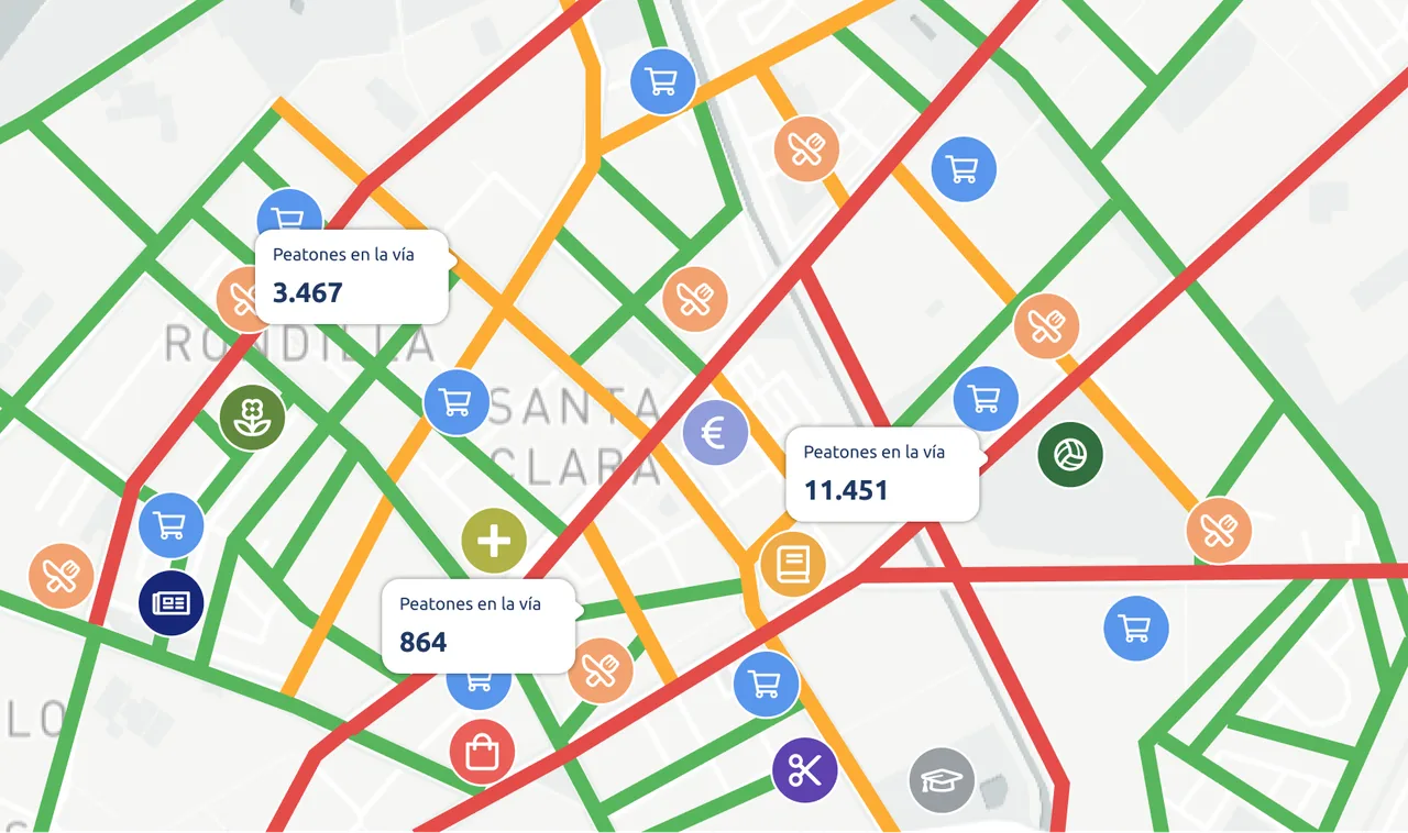
Cities are constantly evolving, creating significant challenges for pedestrian footfall analysis and urban planning. Using advanced data analysis and geolocation tools, we have developed an innovative system that provides deep insight into pedestrian movement patterns and the influence of points of interest (POIs) on footfall across urban areas.
1. Telecom Antenna Location Data
We start with location data from telecom operators’ antennas. We analyse these data to provide an accurate view of pedestrian footfall in urban, suburban and rural areas.
2. Geographic Data Integration
The second step is integrating data from multiple sources. This includes detailed information about points of interest in the city, such as supermarkets, gyms, laundrettes and other businesses. By combining these sources, we create a complete map of how these points are distributed across the city.
3. Identifying Key Areas
Using advanced geospatial analysis techniques, we identify key areas where points of interest and populated zones are concentrated. This helps us determine which parts of a city have the highest level of activity and, therefore, greater pedestrian footfall. Combining population data with POI locations gives us an accurate view of how people move through the urban environment.
4. Analysing Pedestrian Segments
Our system also provides a detailed analysis of pedestrian segments, both in urban areas and along busy routes. We classify segments into different categories and apply filters to exclude those that are not relevant to pedestrian analysis. This focuses the analysis on the areas that truly affect footfall in the city.
5. Assessing POI Impact
Each point of interest is classified into specific categories, such as churches, petrol stations, theatres, hotels, travel agencies and shopping centres.
We assign a base weight to each category and adjust these weights by time of day, day of the week and month of the year. This allows us to estimate accurately the impact of pedestrians on segments near POIs. For example, churches may have a significant impact on Sundays, while shopping centres can attract more people at weekends and during shopping seasons.
By applying these weights, we calculate the estimated number of pedestrians on each segment for different periods, providing a complete view of footfall across the city.
Results and Practical Applications
Our analysis produces a rich database detailing the estimated impact of POIs on the urban environment. The information is presented visually and is easy to interpret, enabling urban planners and footfall managers to make informed decisions. For example, a city council can use these data to organise public events on the busiest streets, increasing attendance and the likelihood of success.
Business Expansion
Beyond urban planning, this analysis system gives entrepreneurs and franchises a significant competitive advantage. By understanding where footfall is concentrated, businesses can identify the best locations for new stores or franchise expansion. Knowing which streets will attract the most customers helps maximise visibility and commercial success while optimising investment in property and advertising.
Benefits for Urban and Commercial Management
- Pedestrian Flow Optimisation: By understanding where and when pedestrian movement is concentrated, cities can introduce measures to reduce congestion and improve walkability.
- Efficient Planning: The data enables more efficient urban planning, ensuring that new infrastructure is developed where it is most needed.
- Improved Safety: By identifying movement hotspots, cities can take steps to improve street safety and reduce the risk of accidents.
- A Better Citizen Experience: Better-managed pedestrian flows improve quality of life, with less waiting and easier access to services.
- Smarter Commercial Expansion: Businesses can use these data to choose strategic locations, attract more customers and improve economic performance.
- Public Event Planning: City councils can organise events on the busiest streets, increasing public participation and bringing urban life to the city.
Conclusion
Our pedestrian footfall analysis system is an intelligent, advanced solution for modern cities. By integrating data from multiple sources and applying sophisticated geospatial analysis, we provide a powerful tool for planning and managing pedestrian movement.
With this information, cities can make more informed and strategic decisions that improve mobility, safety and quality of life. Businesses can also use these insights to expand effectively and profitably.
Would you like to learn how Pickgeo can help your organisation make strategic decisions based on sociodemographic and property data?
Contact us today to request a demo and discover the power of data!